The Boulder play park starts above Eben G. Fine park on the west side of Boulder and ends at the eastern edge of the park. "Play park" is a bit of a misnomer as the artificial drops were designed long ago before small planing hulled boats. The holes tend to be sticky with very few surfing opportunities. To give you an idea of the "play", some local hardcore V+ boaters take their creekboats into the park during runoff to do hole ride training in preparation for their Cali trips. The park is good for boof practice as a cool down for the canyon run or an espresso start to the town run. On warm summer days it's a hotbed for scantily clad intoxicated tubers. Above around 500 cfs the city closes the creek to everybody except kayakers.
My first exposure to the park was before my kayaking days, when someone invited me to go tubing while I was a graduate student at CU. I consider myself a tubing expert from some summer days growing up in the Texas Hill Country. Boulder creek tubing, however, is hardcore. The water is always frigid, there are rocks, and the drops are relatively large for tubing. As I recall, at the first drop I got instantly ejected from my tube, recirculated once in the hole, and shot downstream pinballing off rocks as I vigorously swam after my tube.
The town run proper starts as you exit the park. In general the run gets easier the further downstream you go, starting off as class III and petering out to class II. Most people take out at or before CU East campus between 30th St. and Foothills Pwky, but I've seen people boating as far down as 75th St. Unfortunately, the water quality takes a noticeable dive as pollutates pour in from the environmentally sensitive town of Boulder. Even though this stretch is easy, the shallow and continuous creekbed make it only marginally suitable for novice boaters, and wood and manmade hazards are frequently present.
Gauge Links
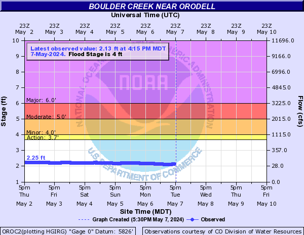
Boulder creek near Orodell: https://www.dwr.state.co.us/SurfaceWater/data/detail_graph.aspx?ID=BOCOROCO&MTYPE=DISCHRG
Four mile creek near Orodell: https://waterdata.usgs.gov/co/nwis/uv?site_no=06727500
Alternate downstream gauge: http://waterdata.usgs.gov/co/nwis/uv?site_no=06730200
| KSC | |
| Class | III |
| Current Flow |
232.0 CFS 06-26-2019 08:15 
View River Forecast |
|
Alternative Flow ([BOULDER CREEK NEAR ORODELL]) |
66.9 CFS 10-20-2013 15:46 |
| Recommended Flow |
Minimum: 150.0 Average: 400.0 Maximum: 700.0 |
| Typical Season |
Begins: June Ends: August |
| Recommended Use |
Kayaking: Yes Rafting: No Canoeing: Yes SUP: No Packrafting: No Fishing: No |
| Primary Gauge | BOULDER CREEK NEAR ORODELL |
| Length | 3.0 Mile(s) |
| Gradient | 60.0 FPM |